About the CoMSES Model Library more info
Our mission is to help computational modelers at all levels engage in the establishment and adoption of community standards and good practices for developing and sharing computational models. Model authors can freely publish their model source code in the Computational Model Library alongside narrative documentation, open science metadata, and other emerging open science norms that facilitate software citation, reproducibility, interoperability, and reuse. Model authors can also request peer review of their computational models to receive a DOI.
All users of models published in the library must cite model authors when they use and benefit from their code.
Please check out our model publishing tutorial and contact us if you have any questions or concerns about publishing your model(s) in the Computational Model Library.
We also maintain a curated database of over 7500 publications of agent-based and individual based models with additional detailed metadata on availability of code and bibliometric information on the landscape of ABM/IBM publications that we welcome you to explore.
Displaying 5 of 5 results urban planning clear search
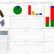
Residents planned behaviour of waste sorting to explore urban situations
Jonathan Edgardo Cohen | Published Wednesday, June 07, 2023 | Last modified Thursday, March 14, 2024Municipal waste management (MWM) is essential for urban development. Efficient waste management is essential for providing a healthy and clean environment, for reducing GHGs and for increasing the amount of material recycled. Waste separation at source is perceived as an effective MWM strategy that relays on the behaviour of citizens to separate their waste in different fractions. The strategy is straightforward, and many cities have adopted the strategy or are working to implement it. However, the success of such strategy depends on adequate understanding of the drivers of the behaviour of proper waste sorting. The Theory of Planned Behaviour (TPB) has been extensively applied to explain the behaviour of waste sorting and contributes to determining the importance of different psychological constructs. Although, evidence shows its validity in different contexts, without exploring how urban policies and the built environment affect the TPB, its application to urban challenges remains unlocked. To date, limited research has focused in exposing how different urban situations such as: distance to waste bins, conditions of recycling facilities or information campaigns affect the planned behaviour of waste separation. To fill this gap, an agent-based model (ABM) of residents capable of planning the behaviour of waste separation is developed. The study is a proof of concept that shows how the TPB can be combined with simulations to provide useful insights to evaluate different urban planning situations. In this paper we depart from a survey to capture TPB constructs, then Structural Equation Modelling (SEM) is used to validate the TPB hypothesis and extract the drivers of the behaviour of waste sorting. Finally, the development of the ABM is detailed and the drivers of the TPB are used to determine how the residents behave. A low-density and a high-density urban scenario are used to extract policy insights. In conclusion, the integration between the TPB into ABMs can help to bridge the knowledge gap between can provide a useful insight to analysing and evaluating waste management scenarios in urban areas. By better understanding individual waste sorting behaviour, we can develop more effective policies and interventions to promote sustainable waste management practices.
The Urban Drought Nexus Tool
Roger Cremades Muhamad Khairulbahri | Published Thursday, December 14, 2023The “Urban Drought Nexus Tool” is a system dynamics model, aiming to facilitate the co-development of climate services for cities under increasing droughts. The tool integrates multiple types of information and still can be applied to other case studies with minimal adjustments on the parameters of land use, water consumption and energy use in the water sector. The tool needs hydrological projections under climate scenarios to evaluate climatic futures, and requires the co-creation of socio-economic future scenarios with local stakeholders. Thus it is possible to provide specific information about droughts taking into account future water availability and future water consumption. Ultimately, such complex system as formed by the water-energy-land nexus can be reduced to single variables of interest, e.g. the number of events with no water available in the future and their length, so that the complexities are reduced and the results can be conveyed to society in an understandable way, including the communication of uncertainties. The tool and an explanatory guide in pdf format are included. Planned further developments include calibrating the system dynamics model with the social dynamics behind each flow with agent-based models.
Peer reviewed Yards
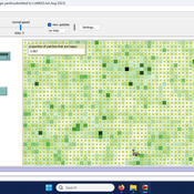
Emily Minor Soraida Garcia srailsback Philip Johnson | Published Thursday, November 02, 2023This is a model of plant communities in urban and suburban residential neighborhoods. These plant communities are of interest because they provide many benefits to human residents and also provide habitat for wildlife such as birds and pollinators. The model was designed to explore the social factors that create spatial patterns in biodiversity in yards and gardens. In particular, the model was originally developed to determine whether mimicry behaviors–-or neighbors copying each other’s yard design–-could produce observed spatial patterns in vegetation. Plant nurseries and socio-economic constraints were also added to the model as other potential sources of spatial patterns in plant communities.
The idea for the model was inspired by empirical patterns of spatial autocorrelation that have been observed in yard vegetation in Chicago, Illinois (USA), and other cities, where yards that are closer together are more similar than yards that are farther apart. The idea is further supported by literature that shows that people want their yards to fit into their neighborhood. Currently, the yard attribute of interest is the number of plant species, or species richness. Residents compare the richness of their yards to the richness of their neighbors’ yards. If a resident’s yard is too different from their neighbors, the resident will be unhappy and change their yard to make it more similar.
The model outputs information about the diversity and identity of plant species in each yard. This can be analyzed to look for spatial autocorrelation patterns in yard diversity and to explore relationships between mimicry behaviors, yard diversity, and larger scale diversity.
City Sandbox
Javier Sandoval | Published Thursday, January 09, 2020This model grows land use patterns that emerge as a result of land-use compatibilities stablished in urban development plans, land topography, and street networks. It contains urban brushes to paint streets and land uses as a way to learn about urban pattern emergence through free experimentation.
The purpose of this model is to enhance a basic ABM through a simple set of rules identified using the activity-driven models in order to produce more realistic patterns of pedestrian movement.


