About the CoMSES Model Library more info
Our mission is to help computational modelers at all levels engage in the establishment and adoption of community standards and good practices for developing and sharing computational models. Model authors can freely publish their model source code in the Computational Model Library alongside narrative documentation, open science metadata, and other emerging open science norms that facilitate software citation, reproducibility, interoperability, and reuse. Model authors can also request peer review of their computational models to receive a DOI.
All users of models published in the library must cite model authors when they use and benefit from their code.
Please check out our model publishing tutorial and contact us if you have any questions or concerns about publishing your model(s) in the Computational Model Library.
We also maintain a curated database of over 7500 publications of agent-based and individual based models with additional detailed metadata on availability of code and bibliometric information on the landscape of ABM/IBM publications that we welcome you to explore.
Displaying 10 of 334 results for "Miriam C. Kopels" clear search
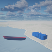
Seascapes of the Unreal: Using Agent Based Modeling to Examine Traditional Coast Salish Maritime Mobility
Adam Rorabaugh | Published Friday, December 22, 2023Non-traditional tools and mediums can provide unique methodological and interpretive opportunities for archaeologists. In this case, the Unreal Engine (UE), which is typically used for games and media, has provided a powerful tool for non-programmers to engage with 3D visualization and programming as never before. UE has a low cost of entry for researchers as it is free to download and has user-friendly “blueprint” tools that are visual and easily extendable. Traditional maritime mobility in the Salish Sea is examined using an agent-based model developed in blueprints. Focusing on the sea canoe travel of the Straits Salish northwestern Washington State and southwest British Columbia. This simulation integrates GIS data to assess travel time between Coast Salish archaeological village locations and archaeologically represented resource gathering areas. Transportation speeds informed by ethnographic data were used to examine travel times for short forays and longer inter-village journeys. The results found that short forays tended to half day to full day trips when accounting for resource gathering activities. Similarly, many locations in the Salish Sea were accessible in long journeys within two to three days, assuming fair travel conditions. While overall transportation costs to reach sites may be low, models such as these highlight the variability in transport risk and cost. The integration of these types of tools, traditionally used for entertainment, can increase the accessibility of modeling approaches to researchers, be expanded to digital storytelling, including aiding in the teaching of traditional ecological knowledge and placenames, and can have wide applications beyond maritime archaeology.
This is v0.01 of a UE5.2.1 agent based model.
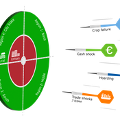
DARTS: modelling effects of shocks on global, regional, urban and rural food security
Pepijn van Oort Hubert Fonteijn Geerten Hengeveld | Published Tuesday, June 18, 2024Food trade networks represent a complex system where food is periodically produced in different regions of the world. Food is continuously stocked and traded. Food security in a globalised world is vulnerable to shocks. We present DARTS, a new agent based model that models monthly dynamics of food production, trade, stocking, consumption and food security for different interconnected world regions and a city state. Agents in different regions differ in their harvest seasons, wealth (rich and poor), degree of urbanisation and connection to domestic and global markets. DARTS was specifically designed to model direct and indirect effects of shocks in the food system. We introduce a new typology of 6 distinct shock types and analyse their impact on food security, modelling local and global effects and short term and longer term effects. An second important scientific novelty of the model is that DARTS can also model indirect effects of shocks (cascading in space and in time, lag effects due to trade and food stock buffering). A third important scientific novelty of the model is its’ capability of modelling food security at different scales, in which the rural/urban divide and differences in (intra-annually varying) production and trade connections play a key role. At the time of writing DARTS is yet insufficiently parameterised for accurate prediction for real world regions and cities. Simulations for a hypothetical in silico world with 3 regions and a city state show that DARTS can reproduce rich and complex dynamics with analogues in the real world. The scientific interest is more on deepening insight in process dynamics and chains of events that lead to ultimate shock effects on food security.
An agent-based model to simulate field-specific nitrogen fertilizer applications in grasslands
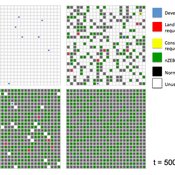
Andrea Kaim Thomas Schmitt Sylvia Helena Annuth Maria Haensel Thomas Koellner | Published Sunday, February 09, 2025Grasslands have a large share of the world’s land cover and their sustainable management is important for the protection and provisioning of grassland ecosystem services. The question of how to manage grassland sustainably is becoming increasingly important, especially in view of climate change, which on the one hand extends the vegetation period (and thus potentially allows use intensification) and on the other hand causes yield losses due to droughts. Fertilization plays an important role in grassland management and decisions are usually made at farm level. Data on fertilizer application rates are crucial for an accurate assessment of the effects of grassland management on ecosystem services. However, these are generally not available on farm/field scale. To close this gap, we present an agent-based model for Fertilization In Grasslands (FertIG). Based on animal, land-use, and cutting data, the model estimates grassland yields and calculates field-specific amounts of applied organic and mineral nitrogen on grassland (and partly cropland). Furthermore, the model considers different legal requirements (including fertilization ordinances) and nutrient trade among farms. FertIG was applied to a grassland-dominated region in Bavaria, Germany comparing the effects of changes in the fertilization ordinance as well as nutrient trade. The results show that the consideration of nutrient trade improves organic fertilizer distribution and leads to slightly lower Nmin applications. On a regional scale, recent legal changes (fertilization ordinance) had limited impacts. Limiting the maximum applicable amount of Norg to 170 kg N/ha fertilized area instead of farm area as of 2020 hardly changed fertilizer application rates. No longer considering application losses in the calculation of fertilizer requirements had the strongest effects, leading to lower supplementary Nmin applications. The model can be applied to other regions in Germany and, with respective adjustments, in Europe. Generally, it allows comparing the effects of policy changes on fertilization management at regional, farm and field scale.
Exploring Transitions towards Sustainable Construction
César García-Díaz Jesus Rosales-Carreon | Published Wednesday, October 30, 2013 | Last modified Saturday, January 31, 2015This model illustrates actor interaction in the construction sector, according to information gathered in NL. It offers a simple frame to represent diverse interests, interdependencies and effects on the number of built sustainable houses.
Peer reviewed AgentEx
Nanda Wijermans Caroline Schill Therese Lindahl Maja Schlüter | Published Sunday, November 13, 2016AgentEx aims to advance understanding of group processes for sustainable management of a common pool resource (CPR). By supporting the development and test explanations of cooperation and sustainable exploitation.
Peer reviewed SWIRS Spread of a woody invader in riparian systems
Beatriz Sosa Moira Zellner Carlos Andrés Chiale | Published Tuesday, May 09, 2023Riparian forests are one of the most vulnerable ecosystems to the development of biological invasions, therefore limiting their spread is one of the main challenges for conservation. The main factors that explain plant invasions in these ecosystems are the capacity for both short- and long-distance seed dispersion, and the occurrence of suitable habitats that facilitate the establishment of the invasive species. Large floods constitute an abiotic filter for invasion.
This model simulates the spatio-temporal spread of the woody invader Gleditsia. triacanthos in the riparian forest of the National Park Esteros de Farrapos e Islas del Río Uruguay, a riparian system in the coast of the Uruguay river (South America). In this model, we represent different environmental conditions for the development of G. triacanthos, long- and short-distance spread of its fruits, and large floods as the main factor of mortality for fruit and early stages.
Field results show that the distribution pattern of this invasive species is limited by establishment, i.e. it spreads locally through the expansion of small areas, and remotely through new invasion foci. This model recreates this dispersion pattern. We use this model to derive management implications to control the spread of G. triacanthos
Equity Constrained Dispatching Model of Emergency Medical Services
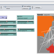
Sreekanth V K Ram Babu Roy | Published Thursday, September 08, 2016 | Last modified Monday, May 01, 2017Model for evaluating various ambulance dispatching policies of an equity constrained emergency medical services under bounded rationality.
Collective Decision Making for Ecological Restoration
Cristy Watkins Dean Massey Jeremy Brooks Kristen Ross Moira Zellner | Published Friday, December 30, 2011 | Last modified Friday, November 21, 2014We present an agent-based model that maps out and simulates the processes by which individuals within ecological restoration organizations communicate and collectively make restoration decisions.
Alpine land-use allocation model - ALUAM-AB
Simon Briner | Published Tuesday, January 31, 2012 | Last modified Saturday, April 27, 2013A model for simulating farmers and foresters response on changing climate and changing socio-economic parameters. Modeled are changes in land-use as well as in ecosystem services provision.
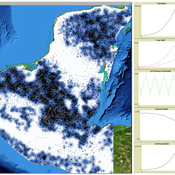
MayaSim: An agent-based model of the ancient Maya social-ecological system
Scott Heckbert | Published Wednesday, July 11, 2012 | Last modified Tuesday, July 02, 2013MayaSim is an agent-based, cellular automata and network model of the ancient Maya. Biophysical and anthropogenic processes interact to grow a complex social ecological system.
Displaying 10 of 334 results for "Miriam C. Kopels" clear search
