About the CoMSES Model Library more info
Our mission is to help computational modelers at all levels engage in the establishment and adoption of community standards and good practices for developing and sharing computational models. Model authors can freely publish their model source code in the Computational Model Library alongside narrative documentation, open science metadata, and other emerging open science norms that facilitate software citation, reproducibility, interoperability, and reuse. Model authors can also request peer review of their computational models to receive a DOI.
All users of models published in the library must cite model authors when they use and benefit from their code.
Please check out our model publishing tutorial and contact us if you have any questions or concerns about publishing your model(s) in the Computational Model Library.
We also maintain a curated database of over 7500 publications of agent-based and individual based models with additional detailed metadata on availability of code and bibliometric information on the landscape of ABM/IBM publications that we welcome you to explore.
Displaying 8 of 138 results for "Andreas Ihrig" clear search
Residents planned behaviour of waste sorting to explore urban situations
Jonathan Edgardo Cohen | Published Wednesday, June 07, 2023 | Last modified Thursday, March 14, 2024Municipal waste management (MWM) is essential for urban development. Efficient waste management is essential for providing a healthy and clean environment, for reducing GHGs and for increasing the amount of material recycled. Waste separation at source is perceived as an effective MWM strategy that relays on the behaviour of citizens to separate their waste in different fractions. The strategy is straightforward, and many cities have adopted the strategy or are working to implement it. However, the success of such strategy depends on adequate understanding of the drivers of the behaviour of proper waste sorting. The Theory of Planned Behaviour (TPB) has been extensively applied to explain the behaviour of waste sorting and contributes to determining the importance of different psychological constructs. Although, evidence shows its validity in different contexts, without exploring how urban policies and the built environment affect the TPB, its application to urban challenges remains unlocked. To date, limited research has focused in exposing how different urban situations such as: distance to waste bins, conditions of recycling facilities or information campaigns affect the planned behaviour of waste separation. To fill this gap, an agent-based model (ABM) of residents capable of planning the behaviour of waste separation is developed. The study is a proof of concept that shows how the TPB can be combined with simulations to provide useful insights to evaluate different urban planning situations. In this paper we depart from a survey to capture TPB constructs, then Structural Equation Modelling (SEM) is used to validate the TPB hypothesis and extract the drivers of the behaviour of waste sorting. Finally, the development of the ABM is detailed and the drivers of the TPB are used to determine how the residents behave. A low-density and a high-density urban scenario are used to extract policy insights. In conclusion, the integration between the TPB into ABMs can help to bridge the knowledge gap between can provide a useful insight to analysing and evaluating waste management scenarios in urban areas. By better understanding individual waste sorting behaviour, we can develop more effective policies and interventions to promote sustainable waste management practices.
OMOLAND-CA: An Agent-Based Modeling of Rural Households’ Adaptation to Climate Change
Atesmachew Hailegiorgis Claudio Cioffi-Revilla Andrew Crooks | Published Tuesday, July 25, 2017 | Last modified Tuesday, July 10, 2018The purpose of the OMOLAND-CA is to investigate the adaptive capacity of rural households in the South Omo zone of Ethiopia with respect to variation in climate, socioeconomic factors, and land-use at the local level.
MEGADAPT - Socio-hydrological risk model - Theoretical (no data) implementation
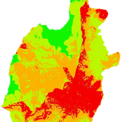
Andres Baeza-Castro Luis Bojorquez Marco Janssen Hallie Eakin | Published Wednesday, February 06, 2019The model simulates the decisions of residents and a water authority to respond to socio-hydrological hazards. Residents from neighborhoods are located in a landscape with topographic complexity and two problems: water scarcity in the peripheral neighborhoods at high altitude and high risk of flooding in the lowlands, at the core of the city. The role of the water authority is to decide where investments in infrastructure should be allocated to reduce the risk to water scarcity and flooding events in the city, and these decisions are made via a multi-objective site selection procedure. This procedure accounts for the interdependencies and feedback between the urban landscape and a policy scenario that defines the importance, or priorities, that the authority places on four criteria.
Neighborhoods respond to the water authority decisions by protesting against the lack of investment and the level of exposure to water scarcity and flooding. Protests thus simulate a form of feedback between local-level outcomes (flooding and water scarcity) and higher-level decision-making. Neighborhoods at high altitude are more likely to be exposed to water scarcity and lack infrastructure, whereas neighborhoods in the lowlands tend to suffer from recurrent flooding. The frequency of flooding is also a function of spatially uniform rainfall events. Likewise, neighborhoods at the periphery of the urban landscape lack infrastructure and suffer from chronic risk of water scarcity.
The model simulates the coupling between the decision-making processes of institutional actors, socio-political processes and infrastructure-related hazards. In the documentation, we describe details of the implementation in NetLogo, the description of the procedures, scheduling, and the initial conditions of the landscape and the neighborhoods.
This work was supported by the National Science Foundation under Grant No. 1414052, CNH: The Dynamics of Multi-Scalar Adaptation in Megacities (PI Hallie Eakin).
Peer reviewed Coupled demographic dynamics of herd and household in pastoral systems
Chelsea E Hunter Daniel C Peart Abigail Buffington Andrew Yoak Ian M Hamilton Mark Moritz | Published Saturday, April 08, 2023This purpose of this model is to understand how the coupled demographic dynamics of herds and households constrain the growth of livestock populations in pastoral systems.
Epidemic Simulation with Transportation Simulation
Moritz Kersting | Published Monday, March 01, 2021The Episim framework builds upon the established transportation simulation MATSim and is capable of tracking agents’ movements within a network and thus computing infection chains. Several characteristics of the virus and the environment can be parametred, whilst the infection dynamics is computed based upon a compartment model. The spread of the virus can be mitigated by restricting the agents’ activity in certain places.
Peer reviewed Gregarious Behavior, Human Colonization and Social Differentiation Agent-Based Model
Sebastian Fajardo Andrés Bernal Gert Jan Hofstede Mark R Kramer Martijn de Vries | Published Thursday, August 20, 2020 | Last modified Thursday, October 29, 2020Studies of colonization processes in past human societies often use a standard population model in which population is represented as a single quantity. Real populations in these processes, however, are structured with internal classes or stages, and classes are sometimes created based on social differentiation. In this present work, information about the colonization of old Providence Island was used to create an agent-based model of the colonization process in a heterogeneous environment for a population with social differentiation. Agents were socially divided into two classes and modeled with dissimilar spatial clustering preferences. The model and simulations assessed the importance of gregarious behavior for colonization processes conducted in heterogeneous environments by socially-differentiated populations. Results suggest that in these conditions, the colonization process starts with an agent cluster in the largest and most suitable area. The spatial distribution of agents maintained a tendency toward randomness as simulation time increased, even when gregariousness values increased. The most conspicuous effects in agent clustering were produced by the initial conditions and behavioral adaptations that increased the agent capacity to access more resources and the likelihood of gregariousness. The approach presented here could be used to analyze past human colonization events or support long-term conceptual design of future human colonization processes with small social formations into unfamiliar and uninhabited environments.
Socio-hydrologicalModel_version_SESMO
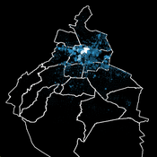
Andres Baeza-Castro Luis Bojorquez Marco Janssen Hallie Eakin Fidel Serrano-Candela Paola Gomez Yosune Miquelajauregui Rodrigo Garcia-Herrera | Published Tuesday, February 05, 2019We present here MEGADAPT_SESMO model. A hybrid, dynamic, spatially explicit, integrated model to simulate the vulnerability of urban coupled socio-ecological systems – in our case, the vulnerability of Mexico City to socio-hydrological risk.
Modeling the emergence of migratory corridors and foraging hotspots of the green sea turtle
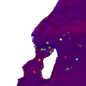
Mayeul Dalleau Volker Grimm Jérôme Bourjea Stephanie Kramer-Schadt | Published Friday, April 05, 2019 | Last modified Tuesday, September 17, 2019The model represents migration of the green sea turtle, Chelonia mydas, between foraging and breeding sites in the Southwest Indian Ocean. The purpose of the model is to investigate the impact of local environmental conditions, including the quality of foraging sites and ocean currents, on emerging migratory corridors and reproductive output and to thereby identify conservation priority sites.
Corresponding article to found here: https://onlinelibrary.wiley.com/doi/epdf/10.1002/ece3.5552
Displaying 8 of 138 results for "Andreas Ihrig" clear search
